Communities Need Better Data and Funding to Increase Wildfire Resilience
This summer, exceptionally dry conditions and an El Niño year have contributed to record-breaking fire seasons in Utah and Oregon. Spokane, Washington lost more than 900 homes to a damaging fire in early August. At time of publication, the wildfire workforce is on high alert under preparedness level 5 (the highest possible level).
In the wake of this season, communities across the West will continue to grapple with how to make investments across a wide variety of priorities to reduce the risk that wildfires will damage communities and livelihoods.
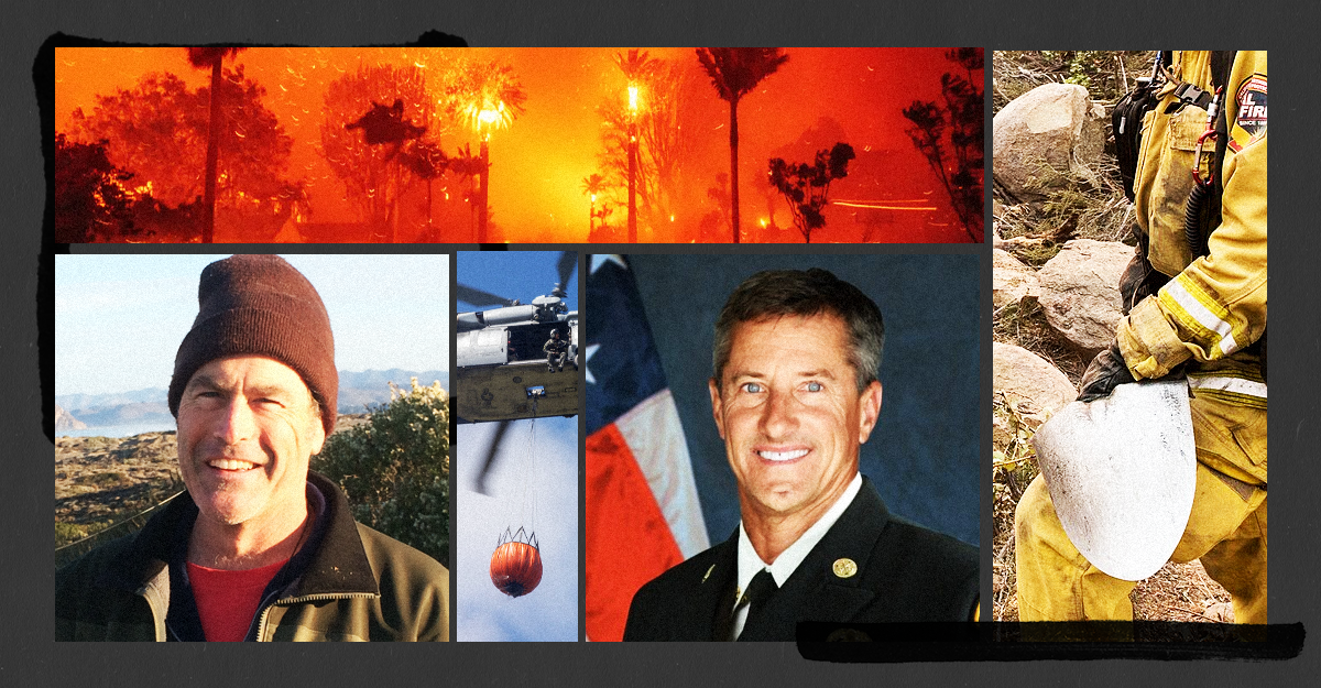
Max Moritz and Rob Hazard have spent decades working to understand how fire behaves and how communities can effectively adapt as wildfires become more frequent and severe. Dr. Max Moritz is a statewide wildfire specialist within UC Cooperative Extension focused on understanding fire at broad scales and applying this knowledge to planning and management. Chief Rob Hazard began his fire service career in 1988 with the U.S. Forest Service working on the Los Padres Hotshot Crew and has since held numerous leadership roles in the California fire ecosystem, including Vice President of the Santa Barbara Fire Safe Council.
Max and Rob are an example of a partnership between academia and operations that helps make joint outputs stronger. The Regional Wildfire Mitigation Program framework they developed together holds promise for helping communities consider their risk and make investments across domains to support resilience. Jessica sat down with Max and Rob to talk about wildfire resilience, collaborating across disciplines, and opportunities and challenges for communities in planning for a future with more fire.
No time to read the whole thing? Here are some key takeaways:
- Federal dollars helped build fire management tools (e.g., models and helicopters) in wide use today, but funding hasn’t kept up as needs have grown. Even well-resourced communities lack the data, resources, and frameworks they need to build resilience.
- Max and Rob led the development of a Regional Wildfire Mitigation Program (RWMP) framework to meet the need for community-scale wildfire risk reduction. It sorts risks and solutions into three overlapping domains: communities, landscape, and built environment.
- In trying to implement this framework, Max and Rob found that the biggest obstacle isn’t knowing what works conceptually; rather, it’s having the data necessary to make informed decisions and evaluate tradeoffs. Regardless, most communities can’t answer basic questions about their own wildfire risk.
- Wildfire resilience relies on basic information on things like how wide roads are (which affects access for firefighting equipment and safe evacuation of residents), what homes are in most need of retrofitting (to reduce ignition vulnerability), where underserved populations are, which high moisture land covers can “buffer” against oncoming wildfire, or what water is available for firefighting. This information is often fragmented, inaccessible, or simply nonexistent.
- Without the information they need, communities tend to fund the easiest projects, or those pushed by the loudest, most affluent voices, rather than the projects most likely to reduce risk.
- The RWMP helps communities name priorities and pinpoint data gaps, but closing them will require state and regional investment. Balancing the desire to get projects on the ground now with the need for longer-term, data-driven planning requires smart policy and thoughtful leadership.
This conversation has been edited for brevity and clarity.
Evolving Approaches to Wildfire Resilience
Jessica Blackband, Senior Manager, Environmental and Climate Policy at FAS: Both of you have dedicated your careers to wildfire resilience from different angles. What’s something you’d highlight about how the field has changed over time?
Rob Hazard: The way we think about the workforce has changed a lot. Humans have really good slow mobility and coordination which make us good at wildland firefighting in difficult terrain, but we know it’s an unhealthy pursuit. It’s tough work. But it could be a hundred years before we have a robot that can do what a human can do on the landscape. In the meantime, I think younger generations are less willing to take on those risks, especially as we learn more about its impacts on the body and mind. We’re having a lot of trouble hiring, and I think those challenges and the needs of the next generation of workers will guide policy in the future.
Let’s say we shifted to an approach more focused on managing fire. You’d still have hot shots out on the landscape, but you could position your crew in safer and less smokey places if you’re not trying to aggressively put a line in [adding a break in vegetation to contain a wildfire] every type of fire. Instead of putting down a line, you could decide to come down from a smokey mountain, let the fire do its thing, and focus on steering it around a natural fire break like a highway or a river. Fire has got to do its work on these landscapes, with some guidance. One of the ways we safely let that happen is that we build differently and we live differently.
Max Moritz: From my perspective in academia, what’s changed is that it used to be a bunch of fire scientists having this whole conversation about wildfire resilience, but through time that’s really shifted. There are a lot more social scientists and researchers from other fields. That older, silverback generation of loud voices has slowly been filled in with several other perspectives which is really helpful.
Hazard: That’s spot on. When I was a young Forest Service employee all the wildfire science was from agencies, or from academic fire behavior analysts. And then there was a backlash from disciplines like fire ecology. Ecologists didn’t have GIS and the data to support some of their ideas, so they were using some coarse data, but they were trying to say that a focus on suppression and fuel breaks could really be a serious problem for local ecosystems. Science has borne that out over time. We also see a big focus on the built environment now, including on the social science side; like Max said, no one ever really talked about that.
Growing Need for Cross-Discipline Collaboration
Where do you wish we had more experts working on the problem?
Mortiz: I wish we could benefit more from the expertise of land use planners and landscape architects. They have so much history and knowledge about how and where we live on the landscape, and authority in some ways, but they’re not actually part of most wildfire conversations. They often defer to fire professionals or fire scientists, but some of us are thinking wait, no, speak up! Sometimes they are heavily invested in other priorities and may just not be thinking as much about fire.
Hazard: I wish we had more resources and experts in the built environment. The built environment is really an engineering problem. We could engineer our way out if we could just physically see how it all works. But to do that, you have to make a model and break it and rebuild it a bunch of times. That’s how Space X built the Falcon rocket. There’s a group at Berkeley working on it and an industry group that built a wind tunnel for research, but in California we have literally no physical place to do experimentation on this stuff.
Mortiz: Fire is very stochastic though. It’s going to look for the weak links. It’s hard to engineer your way completely out of wildfire risk. You can make an otherwise wildfire resilient home and then somebody could leave the window open!
Hazard: Oh, one hundred percent. But if you ask experts: can you at least tell me in the graduated list of improvements, how would you rank home hardening interventions in terms of effectiveness? The experts just aren’t sure. It really depends. And the models we have, they’re so coarse. I think it’ll be years before we have a good model for the built environment.
There are also a lot of influences on planning decisions that make things even more challenging. Right now, local planners are inundated by land use consultants. They get paid by developers to get a project to the approval stage. So the problem is complicated by the fact that there isn’t a one-size fits all approach to creating a fire safe community.
And of course there are concerns about the affordability of improvements and their efficacy relative to how much they cost. I want my daughter and granddaughter to be able to afford a house to live in someday, but I also don’t want them to worry about it burning down.
Mortiz: Right now, we’re largely relying on studies funded by the insurance industry for science about the built environment. I appreciate the resources they’ve poured into it because their work has helped, but it’s just sad that we don’t have more investment from other sources. In the 1950s and 1960s we had trained foresters at federal agencies developing tons of technology related to wildland fire management, like the helicopter systems we use for dropping water and the Rothermel fire spread model that’s still in use today. All of that was done with a lot of taxpayer dollars, more than people think. None of that investment is happening with the built environment.
Regional Wildfire Mitigation Program Framework
No wonder it’s hard for communities to know where to start! You saw firsthand the complexity of mitigation decisions and wanted to help. So you created the RWMP, which was recently highlighted as a model in the California Wildfire Task Force’s Community Roadmap. Tell me more about how that framework came to be.
Mortiz: After the Thomas fire in Ventura and Santa Barbara counties, we knew we needed to do more. Even though we had some Community Wildfire Protection Plans, they had worked better for some neighborhoods than others. Looking back at what worked and what didn’t in California, I thought: what’s the full palette of things that we need to to try to do for risk mitigation? How can we make the palette explicit so communities can consider problems and solutions holistically?
With Rob’s help and conversations with other stakeholders locally, we came up with this conceptual framework of how to break risks and mitigation activities into three domains that overlap and affect each other: communities, landscape, and built environment. The National Fish and Wildlife Foundation agreed to support it, and more recently the Moore Foundation is supporting us in expanding the idea to North County.
How did your complementary expertise support the development of the RWMP, and what made your collaboration work?
Mortiz: As part of University of California’s ANR’s Cooperative Extension, my research and extension activities need to be applied and focused on solutions to fire-related problems. These solutions must incorporate knowledge from many different perspectives and disciplines. In terms of the RWMP, this led me to view all WUI-related fire risks as a complex system, which requires a bunch of data and spatial analysis tools to understand all of the tradeoffs and mitigation scenarios involved. Thankfully, Rob had deep experience in on-the-ground mitigation activities, which was a great compliment to my knowledge and perspective.
Rob’s been in the trenches writing up how to actually implement the RWMP and how to expand it. From the very beginning we knew we didn’t have all the data we knew we needed to do the analysis in these different domains and so expanding it to North County has been exciting and to have the state recognize it is also exciting. But it’s been really difficult to implement here in Santa Barbara given how little data we actually have.
Hazard: It’s been a real eye opener that we don’t have the data to actually do these kinds of things. I’m an operational person by nature and by career. I’ve always been in the trenches, testing things. Build the rocket, break it. Those of us who were really involved in the County have just started implementing things. So the RWMP right now is being implemented in this piecemeal fashion that is within these domains.
Mortiz: Everybody that’s been introduced to the RWMP goes ‘oh my gosh! That’s so great. You have a way to connect all these dots and a methodology of how to think through this.’ But if you look under the hood, we’re still figuring out how to get the data we need to implement the framework. But I have great hope that the framework can be helpful.
Hazard: I think we’ve got something that’s unique, we’re just not done building the rocket and breaking it.
Mortiz: Right, you spec out a spatial decision support tool and after you’ve worked through all the bugs you know more about how it needs to work.
Hazard: I know it frustrates people, but absent millions of dollars in a research budget, the next best thing is just start trying things. California is rolling out more and more money under pressure for home hardening, for mitigating fire risk. But without some way of actually ranking what needs to be addressed based on the features of a community, you default to the low hanging fruit. And usually low hanging fruit is the most shovel ready projects, the projects from the loudest, most vocal communities which are often the whitest and most affluent. It’s not actually going to be used in any even close-to-optimal way to mitigate risk.
Importantly, the things that work here don’t necessarily work in other environments. We have some landscape approaches using agricultural green belts and things like that recent burns scars that are totally irrelevant in a forested environment like Tahoe.
But the methodology is still relevant, right?
Mortiz: The methodology is totally still relevant. But the priorities are different, the spatial inputs are different. Down here in Santa Barbara, for example, greenbelts are super important. Agricultural shapefiles of orchards need to be relevant and accurate. In Tahoe it might be something like a burn scars’ fire return interval or where thinning has been done. Irrigated open space could also work. But it’s the same general concept.
Importance of Data Collection and Interoperability
Are there common data needs in the state that you could meet at that level and if so what are they?
Mortiz: I think there’s more common data needs than there are disparate.
Hazard: That’s true.
Mortiz: Buffers of some kind around a community that can slow a fire down are a common element. Around here buffers might look like live oak stands and in some places they might look like an agricultural buffer, but it’s the same general idea.
Hazard: There’s a golf course in a community I regularly visit that was put in haphazardly 30 years ago and I find myself thinking, I wish they could have put that somewhere else as a buffer for these houses that are vulnerable to fire!
Mortiz: And there are data needs for the road network, for water supplies, for vulnerable populations. All of these things are going to take on different flavors in different communities, but the need is generic.
Hazard: Max just hit on something very important: we have a critical data need for roads. We are so reliant on evacuation to protect lives when there’s a wildfire. Roads are critical for evacuation and critical for planning. Amazingly, our Santa Barbara County Road Network is in GIS, but with no information about how wide the roads are! For evacuation planning, we need to know information about road width so that you can know which roads can pass a horse trailer and a fire truck moving in opposite directions.
Another big problem is that we also don’t analyze roadsize vegetation. The road departments don’t. There’s not something in the line segment representing the road [GIS centerline shape file] that says this is forested, this is grassland, or this is chaparral. Management of roadside vegetation is done completely separately by fire agencies that go out and create a polygon along some roadway.
Mortiz: To make Rob’s point, there’s a wildfire resilience initiative group here at UC Santa Barbara. Their transportation expert grabbed the road data that Rob described because he wanted to do an evacuation analysis. But the files were full of errors, such as attributes that weren’t correct or roads that came together in the data files but that he knew didn’t actually connect. Road information is critical if you want to do an evacuation study. The standard roads layer in Santa Barbara is really insufficient and requires a lot of effort to clean and update to make it useful, and we’re a relatively affluent, resourced, GIS-friendly town. Most places are light years away from being able to do the same thing because of the data gaps.
Hazard: You can find pieces of transportation and road data. The fire department has ignition data, and you can see the dots indicating ignitions following the roads, so we know it’s a problem, but it isn’t correlated directly to the road shape file. So you just have all this disparate data that you have to weave through to try to figure out how to prioritize projects. I know for a fact that roadside vegetation reduction early in the year would drastically reduce the number of ignitions because so many of them are starting on roads, but because it’s not something that’s emphasized other than through a few fire department management plans. Because these data streams are disconnected, they don’t result in or rise to the level of policy.
We also don’t have good structure data. The highest resolution data we have are Microsoft building footprints! No government did that. There’s no map that tells us about fire resilience at the neighborhood level either, like which neighborhoods have more modern construction and are more fire resistant, or which ones have been hardened, or are not fire code compliant.
Do we not have that structure data because of implications for property values?
Hazard: There’s probably a myriad of reasons. It’s going to take a huge effort to go out and collect that data…
Mortiz: And because of effort and privacy. But if you want to do an effective home hardening program, that’s data you’d need to prioritize from neighborhoods. Industries are making decisions using different tools at different scales. If you have better data at the scale of your home it wouldn’t actually probably have anything to do with your insurance. It would just give you the lever you need to to make sure you’re home is safer.
Hazard: Home hardening is a huge amount of effort. The homeowner has to call a contractor and get bids. If the contractors have to do work on the house, it’s disruptive to the homeowner’s life. If it’s an expensive job that’s one thing; but if it’s an inexpensive job you might not be able to find contractors to show up and do it even if there’s grant money for it.
So it’s really important to do public outreach and public education about the need for home hardening. But outreach and public education is also a huge amount of effort. So it’s super important to figure out where you should invest in that education. You don’t want to be doing outreach in a neighborhood where all the houses were built in 2015 and are all dialed and don’t need any upgrades. And you don’t want to do it in a neighborhood where most people rent, because the residents don’t actually have the ability to do the retrofits!
We’re facing this exact obstacle now as we conduct our built environment assessment for Santa Barbara. I might have access to data on the year of a neighborhood of 100 homes, but not information about whether or when they did a remodel. There are building permits on file that have this information, but you’d have to go down to the county and sift through hundreds of building permits to find it. You can see how long this would take. Huge effort! I can sift through the county’s data and for a neighborhood that I think was built around the same year, find year built and the parcel data and then assume that a neighborhood was built between a certain set of years, but you can see how not having fine resolution structural data is a huge obstacle for assessing built environment risk.
You know when we get the data? This is the sad thing. We get the fine resolution data after something like the Palisades Fire. We go in and look at the houses that burned down. And we might find, for example, that one of the houses lost was a two story building built in 1992. Maybe it had a class A roof with double pane windows but not tempered glass. That’s how we find out who was at risk: after the home has already been lost.
Where do you see needed changes happening that give you hope for the future?
Hazard: We do still see problems in the world of policy and government priorities, from housing mandates that compromise wildfire safety to transportation infrastructure not prioritized to wildfire codes not adopted in every state and of course, the ongoing challenges with property and home insurance. We also need a new approach in regards to wildfire suppression policy that needs to start at the federal level.
Although we have discussed the need for more and higher resolution data, there has been a needed sea change in how we approach wildfire risk reduction. There is now broad consensus that the most important mitigations need to happen in the built environment as well as focusing fuels management in buffer zones adjacent to communities. In the broader landscape we also have some agreement that in some forested environments we see a fire deficit, and conversely, some shrublands are experiencing too much fire.Having this broad consensus benefits partnerships and collaborative efforts in the wildfire risk reduction space. We are mostly working from a shared canvas in our combined efforts.
Value of Partnerships to Advance Fire Resilience
Max, I’ve had the pleasure of working with you through several FAS initiatives, including a wildfire policy accelerator. How (if at all) did working with us change your understanding of policy and/or impact your approach?
Mortiz: I was aware of how challenging it can be to have one’s research make an impact on policy, since it’s something I’ve been trying to do for roughly two decades. That pipeline is basically broken. Further, priorities can change almost overnight, like when the current administration took over. What I didn’t realize was how effective a “broker” FAS can be, helping us hone our scientific messages into something more actionable and connecting us with those already involved in policy formation (e.g., the Wildland Fire Policy Accelerator). This experience has convinced me of the benefits possible by working with a partner like FAS instead of going it alone.
Just as sports fanatics had plenty to celebrate this year, so does the heat policy team at FAS. In response to recent heat events, leaders across the country have taken steps to build heat resilience.
Western states functionally manage trillions in global climate risk (permafrost, forest carbon, etc.) and can do so in ways that drive state economic development.
Implementation will not be easy. Several of the plan’s critical strategies challenge established utility business models.
We won’t solve the cost-of-living crisis without improving the capacity of state public utility commissions to protect customers, find and implement new solutions to meet rising demand, and realign broken utility incentives.