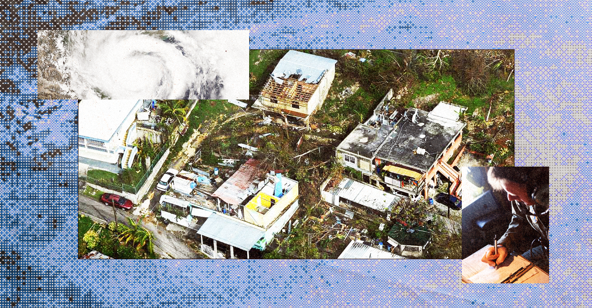
Federal Data Help Communities Prepare for, Respond to, and Recover from Hurricanes. Data Terminations Will Make Them More Deadly.
When a hurricane hits, it’s all hands on deck – that goes for federal data, too. The National Weather Service’s hurricane forecasts get most of the attention, but data supporting preparedness, response, recovery, and resilience pull from all corners of the federal government. What would happen if those essential data didn’t show up for the next disaster? Or if they did, but were out of date, untrustworthy, or less detailed than they needed to be?
In this post, we cover a slate of federal data essential to the disaster lifecycle, but it’s worth noting that right now all federal data are at risk to varying degrees due to politicization and collateral damage from staffing and contract cuts. The erosion of federal data will make future hurricanes more costly, difficult, and deadly.
Most urgently, changes to policies and methods for the census are likely to impact response rates for the constitutionally-mandated census of all people living in the US. These changes will especially impact data on people in mixed immigration households and detailed data at the neighborhood level and in rural areas.
Emergency planners don’t generally care about federal data policies, but they do need to know how many people are in harm’s way and what their characteristics are so they can get them to safety. For example, the city of New Orleans uses data from the American Community Survey on households without access to a vehicle to determine how many evacuation buses are needed and the ideal locations for pickup. A complete and accurate census count helps ensure there is a seat on the bus for everyone who needs it. But if there’s a significant undercount for any reason, there might not be enough seats.
Hurricane Preparedness
Communities need actionable insights long before winds pick up to evacuate safely and protect vulnerable neighbors.
Ocean conditions directly shape storm behavior. Real-time ocean profiling from ARGO float data provides ocean temperature and salinity measurements that help forecasters predict rapid storm intensification before landfall, giving coastal communities crucial extra hours to issue evacuation orders. This helps locals make the decision about whether to evacuate or shelter in place – a high-stakes decision that is especially important for people with disabilities and the elderly.
At the same time, public health officials must account for residents who rely on electricity-dependent equipment such as home ventilators for conditions like ALS and emphysema, or dialysis machines for people with kidney disease. Ahead of a hurricane, planners can use HHS emPOWER Program data to cross-reference projected power outage zones, pre-position mobile generators, and staff medical shelters so no one relying on life-sustaining medical technology is left in the dark.
Response and Relief
During a storm, the local emergency operations center is managing the response – taking in lots and lots of local data at a rapid pace. Of course they are still relying heavily on federal weather data, and they also are probably using data from different federal agencies like the Department of Energy on the locations of critical infrastructure.
On the ground, emergency responders rely on maps of critical infrastructure. Homeland Infrastructure Foundation-Level Open (HIFLD-OPEN) data brought together 300+ geospatial datasets for this purpose – a digital “go bag” for emergency responders. This collection included datasets about the location of:
- resources like hospitals and fire stations,
- hazards like nuclear facilities and concentrated animal feeding operations (and the toxic waste they produce), and
- vulnerable populations, like those in nursing homes or childcare centers.
When DHS unexpectedly terminated HIFLD-OPEN last year, civic tech groups restored public access by creating HIFLD-NEXT, ensuring the first responders who come in to help during disasters have the basic information they need.
When a storm makes landfall, concerns about immediate safety are a priority and slowly shift to emergency relief and the long road to rebuilding. Data, of course, help during those stages too.
As relief efforts transition into recovery, transparency becomes essential. FEMA maintains OpenFEMA, which includes accountability data on FEMA’s Individual and Housing Assistance programs. These data provide transparency about the populations receiving disaster assistance, help evaluate future needs, and allow community leaders to manage the performance of their disaster response programs.
Recovery and Resilience
As things shift to recovery, federal agencies start assessing the impact of the hurricane so they can deliver resources where needed.
During short term recovery, damage assessments create a lot of data. In some cases, it’s FEMA contractors documenting degree of damage to buildings. A lot of intel about community needs also comes from forms and applications such as the FEMA’s Individual and Housing Assistance programs (including residents’ age, whether they own or rent, their income, and whether they have flood insurance).
For longer term recovery and targeting federal funds to build future resilience a wide array of federal data come into play. For example:
- HUD’s quarterly USPS Address Vacancies data shine a light on how different neighborhoods are recovering from the storm over time. It measures vacancies, but more importantly, housing units that are uninhabitable and therefore cannot receive mail. This is useful in highlighting parts of town that need extra assistance in the recovery, and helps local government and nonprofits target redevelopment grants and housing assistance programs.
- NOAA’s Sea Level Rise data shows how specific properties might be impacted by rising waters. This helps the owner of a coastal business that flooded know how high they should raise their new HVAC so it will stay dry in future flood events.
- The National Wetlands Inventory, maintained by the USFWS, is important because wetlands serve as the first line of defense against incoming water. These data help municipal planners and the Army Corp of Engineers identify natural buffer zones that absorb storm surge so they can prioritize coastal restoration projects that shield low-lying residential areas from flooding.
- The National Hurricane Center uses a list of six future years of hurricane names and maintains an historical database of retired names that goes back to 1954. By relying on storm naming conventions from an international consensus organization, like the World Meteorological Organization, these reference data reduce ambiguity for the insurance industry around which storm they’re providing coverage for, making for smoother payouts.
- Finally, understanding where recovery money encounters friction is vital for future storm readiness. By analyzing obligations versus outlays on USAspending.gov, officials can identify and remedy funding bottlenecks and better coordinate disaster spending in the future.
Whether tracking ocean conditions or identifying neighborhoods reliant on home medical equipment, federal data remain an essential foundation for community resilience before, during, and long after the storm. Pulling back from our investments in timely, accurate, and accessible public data will only make us less prepared and put us all at greater risk.
Listen to Denice and Chris on their monthly Data Dish segment on The Federal Drive with Terry Gerton.
Congress should establish a Modeling, Analysis, and Technical Talent for Energy Regulation Hub (MATTER Hub) within the Department of Energy (DOE).
The potential implication of these evidence gaps becomes more consequential when you look at how institutions actually make decisions day to day.
Every new institution inherits something – existing incentives, existing staff, decades of prior investment that shaped what’s possible.
When a hurricane hits, it’s all hands on deck – that goes for federal data, too. Pulling back from our investments in timely, accurate, and accessible public data will only make us less prepared and put us all at greater risk.