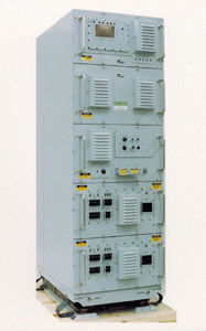
The United States Navy

COMMAND, CONTROL, COMMUNICATIONS,
COMPUTERS, AND INTELLIGENCE (C4I)

Joint Service/Navy-Wide Systems

ADNS
Automated Digital Network System

Description: ADNS provides ship and shore Internet Protocol (IP) connectivity, facilitating the merging of “stove-piped” information-exchange systems and increasing the effective throughput of existing Radio Frequency (RF) circuits. Specifically, it automates the routing and switching of tactical and strategic C4I data via Transmission Control Protocol/Internet Protocol (TCP/IP) networks linking deployed battle group units with each other and with the Defense Information Systems Network (DISN) ashore via multiple Radio Frequency (RF) paths. ADNS uses Commercial Off-The-Shelf (COTS), non-developmental Joint Tactical Architecture (JTA)- compliant hardware (routers, processors, and switches) and commercial “Y2K”-compliant software in a standardized, scalable, shock-qualified rack design.

Program Status: Twenty-eight shipboard and four shore systems have been fielded to date. Afloat installations include carriers, cruisers, command ships, amphibious ships, frigates and destroyers; the shore installations of multiple ADNS nodes have been fielded at the three NCTAMS as well as in Bahrain. Plans for FY 1999 and beyond are to continue battle group fielding in accordance with the IT21 (Information Technology for the 21st Century) fielding matrix.

Developer/Manufacturer: Space and Naval Warfare Systems (SPAWAR) Command, San Diego, California; SPAWAR Systems Center (SSC), San Diego; and Science Applications International Corporation (SAIC), Arlington, Virginia.

ATDL Link-11/22
Advanced Tactical Data Link Program

Description: The ATDL Link-11/22 Program improves Link-11 connectivity and reliability into the next century and funds Link-22. Link-11 is the common tactical data link for all U.S. Navy and allied ships not equipped with Link-16; it will remain in service until at least 2015. Link-22 is the next-generation NATO tactical data link and will implement the Joint Message Standard (TADIL- J). A large percentage of U.S. Link-capable aircraft and a very large segment of allied Link- capable forces are only Link-11 or will be only Link-22 capable in the future. This program improves advanced tactical data link fleet support, provides training support, and promotes equipment commonality and interoperability. Major supported efforts are as follows:

Program Status: Delivery of initial CSDTS production units began in early FY 1998. Approximately 190 CSDTS installations are planned. CDLMS delivery begins in FY 1999. Three MULTS vans are deployed with Commander-in-Chief, U.S. Naval Forces Europe (CINCUSNAVEUR), and five MULTOTS units are operated worldwide. NILE is a co-development program with seven NATO nations and is in the latter half of its research and development phase.

Developer/Manufacturer: GAC, Valley Forge, Pennsylvania; MIKROS, Princeton, New Jersey; Logicon, San Diego, California; NILE Program Management Office, Washington, D.C.; and Rockwell International, Dallas, Texas.

GBS
Global Broadcast Service

Description: Joint tactical operations require high-speed, multi-media communications, and information flow for deployed, in-transit, or garrisoned forces, including lowest-echelons and small users. The Global Broadcast Service (GBS) will augment and interface with other communications systems to provide a continuous, high-speed, one-way flow of high-volume information supporting routine operations, training and military exercises, special activities, crisis, situational awareness, weapons targeting, intelligence, and the transition to and conduct of operations short of nuclear war. GBS will provide the capability to disseminate large information products to various joint- and small-user platforms quickly. GBS will revolutionize communications with increased capacity, faster delivery of data, near-real-time receipt of imagery and data to the warfighter, and reduced over-subscription of current MILSATCOM systems.

Program Status: The GBS space segment will be implemented in three phases. Phase II is the Chief of Naval Operations-sponsored interim-GBS capability hosted on the last three UHF Follow- On (UFO) communications satellites. Launch of these satellites will be completed in FY 1999. The Navy plans to field GBS user terminals on all surface and submarine platforms and most shore facilities. Deployment on various aircraft platforms is under study. The current fielding plan equips 90% of combatant ships and submarines and achieves 70% installation of all user receive terminals within the FY 2000-2005 Future Years Defense Plan.

Developer/Manufacturer: Joint Program Office: U.S. Air Force, MILSATCOM Program Office, Space and Missile Systems Center. Phase II satellites: U.S. Navy SPAWAR, and Hughes, Los Angeles, California. Phase II broadcast management and receive suites: Raytheon, El Segundo, California. Phase III satellites: to be determined. User receiver terminals: Various COTS/NDI. Tactical Broadcast Injection Terminals: U.S. Army, CECOM. Broadcast Management: U.S. Air Force, Electronic Systems Center. Information Management capabilities: Defense Information Systems Agency (DISA).

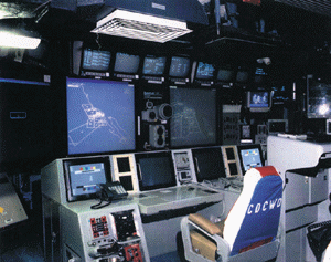
GCCS-M (formerly JMCIS)
Global Command and Control System - Maritime

Description: As the naval implementation of the Global Command and Control System (GCCS), GCCS-Maritime (GCCS-M, formerly the Joint Maritime Command Information System, JMCIS) is the Office of the Secretary of Defense (OSD)-designated command and control (C2) migration system for the Navy. The evolutionary integration of many previous C2 and intelligence systems, it supports multiple warfighting, manpower, and logistics missions for commanders at every echelon, in all afloat, ashore, and tactical naval environments, and for joint, coalition, and allied forces. GCCS-M meets the joint and service requirements for a single, integrated, scalable Command, Control, Computer, and Intelligence (C3I) system that receives, displays, correlates, fuses, and maintains geo-locational track information on friendly, hostile, and neutral land, sea, and air forces and integrates it with available intelligence and environmental information. The product of GCCS-M is a near-real time, fused situational awareness picture that supports C2 requirements for decisionmakers through every level of operations, from peacetime through war. Key capabilities include: multi-source information management, display and dissemination through extensive communications interfaces, multi-source data fusion and analysis/decisionmaking tools, and force coordination.

GCCS-M replaces several prior command-and-control systems for afloat, ashore, and mobile command centers: the Naval Tactical Command System-Afloat (NTCS-A) and Joint Maritime Command Information System-Afloat (JMCIS-Afloat) for shipboard implementations; the Operational Support System (OSS) and JMCIS-Ashore for fixed shore installations; and the Tactical Support Center (TSC) and JMCIS Tactical/Mobile for mobile facilities. Thus, GCCS-M supports Network-Centric Warfare by receiving, displaying, correlating, fusing and integrating all available information for the warfighter.

Program Status: GCCS-M Afloat will be installed on more than 300 ships and submarines throughout the Navy. All units will be “Y2K” compliant by the end of FY 1999. GCCS-M Ashore has been installed at 26 sites including the Office of the Chief of Naval Operations, five Fleet Commanders-in-Chief (CinCs), Keflavik, Iceland, two Unified CinCs (USACOM and USPACOM), four Fleet High Level Terminal (FHLT) sites, four Submarine Tactical Terminal (STT) sites, and various allied/NATO sites. For GCCS-M Tactical/Mobile — 16 TSCs and eight Mobile Operational Command Centers (MOCCs) are operational worldwide. The program achieved Milestone IIIA for a JMCIS-based modernization of the TSC C4I systems in FY 1995, with a similar upgrade Milestone for the MOCCs completed in FY 1997. The Mobile Integrated Command Facility (MICFAC) and Mobile Ashore Support Terminal (MAST) mobile C4I suites have been integrated into the TSC Program. Five MICFACs and four MAST units were deployed during FY 1995 and 1996. Seven Reserve Force MASTS have been contracted and will be delivered through FY 1999 to the Commander, Naval Surface Reserve Force, to support Mobile Inshore Undersea Warfare (MIUW) missions. All mobile variants will deploy to support fleet and joint operations and exercises during FY 1998 and FY 1999.

Developer/Manufacturer: Various COTS/GOTS.

GFO
Geophysical/Geodetic Satellite Follow-On

Description: The GEOSAT Follow-On (GFO) is a space-based radar altimeter that will provide the Fleet and oceanographic community with global, all-weather ocean topography, significant wave height, and ocean subsurface thermal structure. The GFO is a miniaturized version of the earlier successful U.S. Navy GEOSAT. GFO represents significant advances in small satellite technology and is the first Defense Department launch under the Commercial Space Launch Act. Designed to downlink to the AN/SMQ-11 meteorological satellite receiver, the GFO will provide tactical information to afloat naval forces on ocean and littoral currents, tides, fronts, and eddies, as well as synthetic bathythermographs (BT) and sea state estimates.

Program Status: GFO was launched in February 1998. Navy on-orbit acceptance is expected to occur in 1999.

Developer/Manufacturer: Prime: Ball Aerospace Division, Boulder, Colorado. Launch service: Orbital (formerly Orbital Sciences Corp), Dulles, Virginia. Altimeter: Raytheon, St. Petersburg, Florida.

IBS/JTT
Integrated Broadcast Service/Joint Tactical Terminal

Description: This program supports Indications & Warning (I&W), surveillance, and targeting data requirements of operational commanders and targeting staffs across all warfare areas. It consists of broadcast receiver/ transponder equipment that provides target-quality contact data to tactical users. Integrated Broadcast Service (IBS) is a system-of-systems that will migrate the TRAP (TRE and Related Applications) Data Dissemination System (TDDS), Tactical Information Broadcast Service (TIBS), Tactical Reconnaissance Intelligence Exchange System (TRIXS), and TADIXS-B UHF broadcasts into an integrated service with a common format. IBS will also be capable of sending data via other communications paths, such as SHF, EHF, and GBS. Joint Tactical Terminal (JTT) will receive, decrypt, process, format, and distribute tactical data according to preset user-defined criteria across open-architecture equipment. JTT will be modular and will have the capability to receive and display on all current tactical intelligence broadcasts (TDDS, TADIX-B, TIBS, and TRIXS). JTT will also be interoperable with the follow-on to these tactical broadcasts, the IBS.

Program Status: Plans are to transition to the Army-procured JTT beginning in FY 1999.

Developer/Manufacturer: JTT: Raytheon Systems, St. Petersburg, Florida.

JSIPS
Joint Service Imagery Processing System

Description: JSIPS is a mobile ground-processing facility designed to receive and exploit infrared and electro-optical imagery from national and tactical reconnaissance systems. Improvement options include a common radar processor for both tactical and theater radars, and an automated capability to insert and process mapping, charting, and geodesy products. The Navy system, JSIPS-N, will provide rapid and direct imagery from reconnaissance systems to mission planners, ensuring a quick and responsive source of intelligence. Growth capability is planned, with interoperability the key goal. The Navy envisions JSIPS installation on all aircraft carriers, amphibious assault ships, and command ships. Requirements for command ships are being evaluated. JSIPS also offers the Marine Corps the opportunity to acquire a processing facility capable of deploying with Marine Air-Ground Task Forces (MAGTFs).

Program Status: Engineering Development Models were delivered in FY 1992, and Initial Operational Capability occurred in FY 1995. JSIPS-N entered Engineering and Manufacturing Development during FY 1998.

Developer/Manufacturer: GDE Systems, San Diego, California; Raytheon, Garland, Texas; and SAIC, Arlington, Virginia.

JTIDS
Joint Tactical Information Distribution System

Description: This high-capacity digital information distribution system provides rapid, secure, jam- resistant (frequency hopping) communications, navigation, and identification capabilities appropriate for military use up to and including Secret information. JTIDS provides Navy tactical aircraft and ships and Marine Corps units with crypto-secure, jam-resistant, and low-probability- of-exploitation tactical data and voice communication at a high data rate. JTIDS also provides capabilities for common-grid navigation and automatic communications relay. JTIDS is a joint program directed by the Office of the Secretary of Defense (OSD). It has been integrated into numerous platforms and systems, including the aircraft carriers, surface warships, amphibious assault ships, submarines, F-14D Tomcat and E-2C Hawkeye aircraft, the Marine Corps Tactical Air Operations Centers (TAOCs) and Tactical Air Command Centers (TACCs). Other service and foreign nation participants include the U.S. Air Force, U.S. Army, Great Britain, and Canada. Additionally, JTIDS has been identified as the preferred communications link for Theater Ballistic Missile Defense (TBMD) programs. JTIDS is the first implementation of the Joint Message Standard (TADIL-J) and provides the single, real-time, joint data link network for information exchange among joint and combined forces for command and control of tactical operations.

Program Status: The program successfully completed OPEVAL in August 1994 and was authorized to proceed to Full-Rate Production in March 1995. JTIDS is being installed in selected ships and E-2C aircraft during FY 1999, with continued installation planned into the future.

Developer/Manufacturer: GEC-Marconi Electronics Systems, Wayne, New Jersey; Rockwell- Collins Avionics, Cedar Rapids, Iowa; and Northrop Grumman, Bethpage, New York.

Lightweight
Super High Frequency (SHF)
Satellite Communications

Description: The Lightweight Super High Frequency (SHF) Satellite Communications (SATCOM) Terminal enables Navy ships to access the Defense Satellite Communications System (DSCS) for reliable, secure, beyond line-of-sight information exchange at medium-to-high data rates with other fleet units, fixed and mobile Joint and Allied Forces, and Navy C4I commands. Key services available via SHF are as follows:

Program Status: Numbered Fleet Commander flagships, aircraft carriers, flag-capable amphibious ships, and Surveillance Towed Array Sensor (SURTASS) platforms are configured with the AN/WSC-6(V)1 through AN/WSC-6(V)4 lightweight SHF SATCOM terminals. Beginning in FY 1998, the AN/WSC-6(V)4 is being modified to a standard AN/WSC-6(V)5 configuration to provide dual-carrier, air-cooled high-power amplifier and current technology controller capabilities for all flag-configured platforms. In FY 1997, the production contract was awarded for the AN/WSC-6A(V)7 SHF terminal for installation in several surface combatant and amphibious warships and other ship classes. The ultimate goal is to continue expanding SHF SATCOM capability to Combat Logistic Force ships and the Mine Countermeasures Support Ship through a combination of modifications to existing production SATCOM terminals and provision of additional AN/WSC-6(V) terminal variants matched in capability to individual ship mission requirements.

Developer/Manufacturer: Electro-Space, Inc., Dallas, Texas; Raytheon, Marlborough, Massachusetts; and various COTS/NDI vendors.

MIDS–LVT
Multi-functional Information Distribution
System–Low Volume Terminal

Description: MIDS-LVT is a multi-national cooperative development program to design, develop, and produce a tactical information distribution system equivalent to Joint Tactical Information Distribution System (JTIDS), but in a low-volume, lightweight, compact terminal designed for fighter aircraft, with potential applications in helicopters, ships, and ground sites. U.S. Navy procurement is targeted for F/A-18 Hornet aircraft and attack submarines. Other NATO participants are Germany, France, Spain, and Italy. As a Pre-Planned Product Improvement of the JTIDS Class 2 Terminal, the MIDS-LVT will employ the Link-16 (TADIL-J) message standard of U.S. Navy/NATO publications. Although the MIDS-LVT terminal will have the same performance capabilities as the Class 2 JTIDS Terminal, its size and weight will be significantly reduced.

Program Status: The program entered Engineering and Manufacturing Development (EMD) in December 1993. Participating nations have developed an acquisition strategy, with the United States as the program leader. It is expected to enter production in FY 2000.

Developer/Manufacturer: GEC-Marconi Electronics Systems, Wayne, New Jersey; Rockwell- Collins Avionics, Cedar Rapids, Iowa; and Northrop Grumman, Bethpage, New York.

Mini-DAMA
Miniature Demand Assigned Multiple Access

Description: The Mini-DAMA system will provide satellite channel efficiencies for aircraft and submarines by employing time-division multiple-access methods that have been achieved by surface ships and shore stations equipped with the larger version TD-1271 DAMA multiplexer. Mini-DAMA is being developed in two versions: the (V)1 variant is for the submarine ship/shore application, and the (V)3 variant is for the airborne aircraft/shore application.

Program Status: Open Systems Architecture (OSA) units were tested by the prime contractor and the Naval Undersea Warfare Center (NUWC) in New London, Connecticut, and were assessed and evaluated by the Commander, Operational Test and Evaluation Force (COMOPTEVFOR) during FY 1997. RDT&E funding continued in FY 1997 and the assessment of the (V)3 by OPTEVFOR was completed. The AN/USC-142(V) Mini-DAMA terminal is being acquired for installation on nuclear attack submarines, surface mine countermeasures ships, and new- construction guided missile destroyers.

Developer/Manufacturer: Titan Linkabit, San Diego, California.

Navy METOC Sensors (Space)
Meteorological/Oceanographic Sensor Program

Description: The Navy METOC Sensors (Space) program supports Navy interests in meteorological and oceanographic (METOC) space-based remote sensors. These interests include commitments to satellite, sensor, and operational development activities associated with the Defense Meteorology Satellite Program (DMSP) and the National Polar-orbiting Operational Environmental Satellite System (NPOESS). The sensors carried on DMSP and future NPOESS satellites provide global oceanic and atmospheric data of direct operational relevance, including sea surface, wind, sea ice, and precipitation. The program provides for Navy participation in Navy/Air Force cooperative efforts leading to current and future METOC sensor development, including calibration and validation of instruments and delivery of satellite products to the Fleet.

Program Status: In October 1997, the program commenced development of CORIOLIS/WINDSAT, the nation’s first space-based passive microwave polarmetric radiometer, to provide ocean surface wind speed and direction, sea surface temperature, cloud liquid water, rain rate, snow/ice age/thickness, soil moisture, and vegetation index. Launch is planned for February 2002. Development of the Airborne Polarmetric Microwave Imaging Radiometer (APMIR) for calibration and validation (cal/val) of the Air Force Special Sensor Microwave Imager/Sounder (SSMIS) and CORIOLIS/WINDSAT began in early FY 1998. APMIR will be in service in time to support first SSMIS mission on DMSP-F16, scheduled to launch in FY 2001. APMIR will continue as an ongoing cal/val program for DMSP, CORIOLIS/WINDSAT, and NPOESS microwave radiometer sensors. In addition to these projects, a concept study has been completed for a future low-cost sensor that will provide high-resolution visible and infrared METOC imagery of the Indian Ocean region from a geosychronous satellite.

Developer/Manufacturer: Naval Research Laboratory (NRL), Washington, D.C. WINDSAT satellite bus and hardware: To be determined.

NAVSTAR
Global Positioning System (GPS)

Description: The NAVSTAR Global Positioning System (GPS) is a space-based, 22-satellite, radio positioning system that provides users with worldwide, all-weather, three-dimensional positioning, velocity, and precise time data. Navy requirements include the integration of GPS in more than 400 surface ships and submarines and 4,500 aircraft. GPS continues to play an important role not only in navigation, but also in precision strike weapons, Navy surface fire support systems, ship intelligence systems, and complex communication systems that depend on the precise timing signal. In 1996, the President reaffirmed his commitment to offer GPS free of charge to all civilian and military users with non-aggressive intent, and directed the Department of Defense to protect the GPS signal used by U.S. forces and allies and to deny GPS to hostile forces within an area of responsibility.

Program Status: GPS achieved Full Operational Capability in July 1995. As of early 1999, all ships and submarines have GPS; aircraft integration will be 63% complete by the end of FY 1999. The FY 2000 and out-year budgets continue to support equipping naval platforms with GPS capability, as well as to ensure that the signal is protected.

Developer/Manufacturer: Boeing, Anaheim, California; Rockwell-Collins, Cedar Rapids, Iowa; Raytheon, Los Angeles, California; Trimble Navigation, Sunnyvale California; Honeywell, Clearwater, Florida; Litton, Woods Hills, California; and numerous others, both U.S. and foreign.

NESP
Navy Extremely High Frequency
Satellite Communications Program

Description: The Navy Extremely High Frequency (EHF) Satellite Communications (SATCOM) Program (NESP) AN/USC-38(V) is an anti-jam, low-probability-of-intercept (LPI) communications terminal designed to accommodate a wide variety of command-and-control and communications applications (e.g., secure voice, imagery, data, and fleet broadcast systems). As the Navy’s portion of MILSTAR, NESP terminals are essential to providing protected tactical and strategic communications to the naval warfighter. The terminal operates within the EHF uplink and Super High Frequency (SHF) downlink radio frequency spectra. The terminals are interoperable with Army and Air Force terminals and will operate with MILSTAR satellites as well as EHF packages on board Ultra High Frequency (UHF) Follow-On (UFO) satellites 4-10, and with the Fleet Satellite (FLTSAT) EHF packages (FEP) installed on FLTSATs 7 and 8. NESP has three configurations: Submarine (V)1, Ship (V)2, and Shore (V)3.

Program Status: NESP began implementation of terminal modifications required to operate with an Interim Polar satellite with an EHF package. These terminal modifications allow EHF communications to naval forces operating in regions above 65 degrees north. The first of three EHF-equipped satellites was launched into Polar orbit in November 1997. The system will reach Initial Operational Capability in FY 1999. By the end of FY 1998, most Tomahawk land-attack missile-capable surface warships and submarines were EHF SATCOM-capable, allowing EHF to become the primary means for transmitting EHF Mission Data Updates (MDUs). All Tomahawk-capable platforms will have EHF capability by the end of FY 1999. Also in FY 1999, modifications to NESP terminals will begin to allow communications through the Milstar II EHF Medium Data Rate (MDR) payload, the first of which will be launched in FY 1999.

Developer/Manufacturer: Raytheon, Marlboro, Massachusetts.

NSIPS
Navy Standard Integrated
Personnel System

Description: The Navy Standard Integrated Personnel System (NSIPS) is a major automated information system designed to integrate Active, Reserve, and Retired military personnel systems within the Navy. It will improve the military personnel tracking process, consolidate processes and systems within all areas of military personnel, and replace the functionality of four legacy source data collection systems. NSIPS will deliver field-level pay and personnel data to update corporate databases in peacetime as well as during recalls, and during both partial and full mobilization. Most importantly, NSIPS will collect, pass, and report timely, accurate data on Active, Reserve and Retired Navy members in the continental United Status, overseas and aboard ships. NSIPS will have the capacity and flexibility to satisfy customer and user needs at all levels. In addition, it will have the capability to support current and future business processes.

Program Status: The Department of the Navy approved the NSIPS Mission Needs Statement on 3 April 1995. This was validated by the Office of the Under Secretary of Defense for Plans and Resources (OUSD P&R) in May 1995. On 25 July 1995, the Assistant Secretary of Defense for C3I approved Milestone 0 and endorsed the evolutionary program strategy to support the Navy’s need. NSIPS achieved Milestone I on 16 May 1997 and Milestone II was approved on 6 January 1998. Current program management schedules estimate Initial Operational Capability in first quarter FY 2000 and Full Operational Capability four months later.

Developer/Manufacturer: Lockheed Martin, Falls Church, Virginia; PeopleSoft, Bethesda, Maryland; Template, Arlington, Virginia; and CDSI, New Orleans, Louisiana.

NTCSS
Naval Tactical Command
Support System

Description: The Naval Tactical Command Support System (NTCSS) is the afloat, deployable, and ashore system that develops and fields tactical support systems for the Navy and Marine Corps. NTCSS provides the business function information management systems for maintenance, supply, medical, and administrative information through the migrated subsystems of the Shipboard Non-tactical ADP Program (SNAP), the Naval Aviation Logistics Command Management Information System (NALCOMIS), and the Maintenance Resource Management System (MRMS). NTCSS, through future migration to the Defense Information Infrastructure Common Operating Environment (DII COE) technical architecture, will be used to complete the tactical readiness picture for operational commanders.

Program Status: The NTCSS strategy evolves the technical and functional capabilities of the system components. The first stage of NTCSS strategy is hardware modernization and network installations using open system architectures and operating environments at all sites. This hardware environment is common with tactical programs and compliant with Defense Information Infrastructure standards. The second stage involves technical optimization of the functional applications using modern software development tools, relational databases, and a common operating environment. Follow-on stages of the program will involve development and implementation of business process improvements under the sponsorship of functional and fleet managers. The program is currently fielding NTCSS. Optimized on ships and aviation intermediate maintenance activities, afloat and ashore. NTCSS Optimized applications satisfy the logistics needs of our operating forces. Fielding of NTCSS Optimized will be complete by FY 2005.

Developer/Manufacturer: The Commercial Off-The-Shelf (COTS) hardware is being procured through indefinite delivery/indefinite quantity government contracts. Engineering, development, integration, installation, training, and life cycle support will be accomplished through Navy and Defense Department activities.

OBU/OED
Ocean Surveillance Information System
Baseline Upgrade & Evolutionary Development

Description: The Ocean Surveillance Information System (OSIS) Evolutionary Development (OED) program is a shore-based intelligence system providing on-line, automated, near real-time, netted command-and-control support to the Unified Commanders-in-Chief, Joint Task Force commanders afloat and ashore, individual ships, and allies. It receives, processes, and disseminates timely all-source surveillance information on fixed and mobile targets of interest both afloat and ashore. OED provides a multi-level secure system at the message level and automated event-by-event reporting. OED is evolving toward a Global Command and Control System-Maritime (GCCS-M)-compliant system, and employs GCCS-M software and hardware (TAC-X series) while retaining all the functionality of the OBU system.

Program Status: Seven U.S. and allied (United Kingdom, Japan, and Australia) sites will receive the OED hardware and software suite by the end of FY 1999. U.S. sites include: Atlantic Intelligence Center (AIC) at USACOM Headquarters; Joint Intelligence Center–Pacific (JICPAC) at U.S. Pacific Command (USPACOM) Headquarters; JICPAC detachment (J-DET) Yokota Air Force Base, Japan; and Joint Analysis Center (JAC) Molesworth, United Kingdom. The initial OED site for the Republic of Korea Navy will be installed in FY 1999.

Developer/Manufacturer: Inter-National Research Institute, Arlington, Virginia; Litton Industries, McLean, Virginia; TRW, Fairfax, Virginia; Naval Command, Control and Ocean Surveillance Center (NCCOSC) Research and Development (NRaD), San Diego, California, and Dahlgren, Virginia; and Mitsubishi and Hitachi, Tokyo, Japan (for the Japanese Maritime Self-Defense Force OBU only).

SABER
Situational Awareness Beacon with Reply

Description: The SABER system provides critical battlefield/operating area situational awareness and friendly ID capabilities by uniting Global Positioning System and communications technologies. The SABER system consists of a GPS receiver and two-way radio capable of Over- The-Horizon and Line-Of-Sight secure and non-secure communications. The GPS receiver provides an accurate user position, which is broadcast OTH via military communications satellites or LOS to a command-and-control (C2) node interface to the Global Command and Control System (GCCS). SABER beacons can report their identification, position, heading and speed. Reporting rates are scaleable based on the number of beacons on a net and expected speed of reporting platform. For example, aircraft and helicopters would normally have a faster reporting rate than ships. Additionally, SABER-equipped units that are preparing to launch an attack will send an intent-to-shoot LOS transmission indicating the target position and a kill radius. All SABER units receiving this transmission will compare the designated area with their own position. If an overlap exists, a “Don’t Shoot” reply is sent to prevent fratricide. SABER can be fielded on all Navy ships and craft, including landing craft and mine warfare platforms. Navy helicopters and tactical aircraft will receive modified SABER beacons designed to integrate with existing airframe capabilities, reducing additional hardware as much as possible. SABER beacons can also be installed in less than a day on merchant vessels called to support military operations and NATO or coalition forces.

Program Status: SABER is transitioning from a technology demonstrated in the Combat ID- Advanced Concept Technology Demonstration to service procurement. During FY 1999, the Navy will award a production contract. The Navy expects to enter into Low-Rate Initial Production in FY 2000, with Full-Rate Production in FY 2001.

Developer/Manufacturer: Prototypes: Southwest Research Institute (SwRI), San Antonio, Texas. Production Units: To be determined.

SCI ADNS/TACINTEL II+
Sensitive Compartmented Information Automated Digital Network
System/Tactical Intelligence Information Exchange Subsystem

Description: SCI ADNS/TACINTEL II+ is an Internet Protocol (IP)-capable, network-centric, automated message communication system for real-time receipt and transmission of Special Intelligence (SI) and Sensitive Compartmented Information (SCI) messages. The messages are primarily contact reports and other tactically significant information. SCI ADNS is unique as a real-time communication system, operationally integrated with the Tactical Cryptologic Sensor (TCS) systems and their requirement for direct ship-to-ship (i.e., sensor-to-sensor) communication exchange without shore node involvement. SCI ADNS/TACINTEL II+ extends the TACINTEL II system by implementing the Copernicus vision for joint C4I interoperability, using open-architecture standards, and is thus a critical element in the Navy’s evolving concept of Network-Centric Warfare. The full capability will include voice, message, and data transfer among SCI-capable ships and aircraft, with gateways to shore nodes. TACINTEL II+ is the lead program for implementing the SI/SCI portion of the Joint Maritime Communications Strategy (JMCOMS) and Automated Digital Network System (ADNS).

Program Status: Installation of shore TACINTEL Link Control Facilities with new hardware is complete. Upgrading of ship hardware began in FY 1995 and will be completed in FY 2000. Incremental hardware and software upgrades scheduled through FY 2003 and beyond will provide the following capabilities:
    Phase 1: Upgrade ship/shore equipment with IP capable devices
    • Build 1: Install IP orientated software that meets Y2K compliance
    • Build 2: ATM technology insertion
    • Build 3: Integrate voice, data, video capability

    Phase 2: Upgrade to IT21 (Information Technology for the 21st Century) Windows NT systems; complete transition to multi-media environment via JMCOMS and ADNS

SCI ADNS has been designated as an evolutionary program allowing for continued growth and expansion through emerging technology insertion. It provides the mechanism for phased implementation of both planned improvements and those that surface through advancing technology. SCI ADNS provides for the real-time exchange of tactical SCI data to afloat operational commanders. The cornerstone of this program is the versatility and growth potential of the processing and networking equipment which will provide network centric communications for the SI community. The premise of using Commercial Off-The-Shelf, Government Off-The- Shelf, Non-Developmental Items, and existing systems to meet the requirements for SI communications will continue to be followed. To realize the JMCOMS/ADNS architecture, FY 2000 through FY 2001 funds will procure the SCI ADNS equipment necessary to implement the IT21 architecture, providing SI communications to the Fleet.

Developer/Manufacturer: Space and Naval Warfare (SPAWAR) Systems Command, San Diego, California.

UFO
UHF Satellite Communications Follow-On

Description: The UHF Follow-On (UFO) satellite program provides eight satellites and one on- orbit spare to replace the current UHF satellite constellation — comprising Fleet Satellite (FLTSAT), Gapfiller, and Leased Satellite (LEASAT) systems — now nearing the end of its extended service life. UHF SATCOM, via UFO, provides Ultra High Frequency (UHF), Super High Frequency (SHF) Fleet Broadcast (FLTBCST) uplink only, and Extremely High Frequency (EHF) uplink and downlink capabilities for anti-jam communications in the Atlantic, Pacific, and Indian oceans, and continental United States (CONUS). The EHF payload provides anti-jam telemetry tracking and control uplink capability, and modernizes the fleet broadcast uplink. Also, UFOs 8-10 will include a Global Broadcast System (GBS) payload. GBS uses direct broadcast technology at an extremely high data rate to many users via very small terminals.

Program Status: Nine satellites have been procured, six satellites have been launched and are operational. The launch of UFO 1 failed, but funds have been secured to support launch of UFO 10 to replace UFO 1. UFOs 4-10 incorporate an EHF anti-jam capability. The first launch of UFO with GBS capability occurred in 1998. An incremental launch schedule will ensuring that the UFO constellation will be fully in place by the end FY 1999.

Developer/Manufacturer: U.S. Navy, Space and Naval Warfare Systems Command (PMW-146); Hughes, Los Angeles, California.

Airborne Systems

TAMPS
Tactical Aircraft Mission Planning System

Description: TAMPS is the Navy-Marine Corps standard unit-level aircraft mission planning system. It contains data for a wide variety of aviation platforms, including the F/A-18 Hornet, F-14 Tomcat, S-3 Viking, E-2 Hawkeye, and AH-1 Cobra. TAMPS is capable of loading the F/A-18 flight software via a Data Storage Unit (DSU) with route-of-flight data that include waypoints and sequential steering files, air-to-air radar presets, Tactical Aircraft Navigation Aid (TACAN) channels and identification files. TAMPS enables the loading of independent overlays for aircraft software and bulk files for missile software, enabling the use of weapons such as the Stand-off Land Attack Missile (SLAM), Joint Stand-Off Weapon (JSOW) and the Joint Direct Attack Munition (JDAM). TAMPS is also used for loading Joint Tactical Information Distribution System (JTIDS) and Global Positioning System (GPS) files into aircraft flight software, and it is interoperable with the Global Command and Control System-Maritime (GCCS-M).

Program Status: In production. TAMPS reached Initial Operational Capability in 1986. A major upgrade, TAMPS 6.1, passed operational test and was introduced into the Fleet in FY 1998. TAMPS 6.2/6.2K was released in December 1998. The Joint Mission Planning System (JMPS) commenced development in FY 1998. The TAMPS program has also fielded the Navy version of the Portable Flight Planning System (PFPS) developed by the U.S. Air Force (USAF). This system provides flight and mission planning on a PC system. It will have a limited dataload capability in the spring 1999. PFPS will provide the functionality and user interface core for the JMPS being co-developed with USAF and scheduled for release in December 2001. JMPS will be the DII COE-compliant collaborative inter- service mission planning system for the future.

Developer/Manufacturer: TAMPS 6: Naval Air Warfare Center, Weapons Division, Point Mugu, California; Lockheed Martin, Camarillo, California; TRW, Fairfax, Virginia; and Telos Systems Integration/C3, Herndon, Virginia. TAMPS 6.2.1: Naval Air Warfare Center, Weapons Division, Point Mugu, California and GDE, Camarillo, California. JMPS Phase 1 Two Contractors: LOGICON, San Pedro, California and GDE, San Diego, California. JMPS will select one primary contractor in May 1999.

Submarine Systems

HDR
Submarine High Data-Rate Antenna

Description: The submarine High Data-Rate antenna program is the top-priority submarine Command, Control, Communications, Computers, and Intelligence (C4I) initiative and is the Navy’s first multi-band dish antenna. The HDR antenna will provide the submarine force with worldwide high data-rate satellite communications capability. It will enable the submarine to access the secure, survivable Joint MILSTAR Satellite Program in the Extremely High Frequency (EHF) band. It will also provide the capability to receive time critical tactical information from the Global Broadcast Service (GBS). Additionally, the HDR antenna will provide access to the Defense Satellite Communications System (DSCS) in the Super High Frequency (SHF) frequency band.

Program Status: The first Rapid Prototype HDR Antenna was delivered to the Navy in June 1998 and has successfully completed testing. The first installation is scheduled for November 1999.

Developer/Manufacturer: Raytheon, Marlboro, Massachusetts.

Surface Systems

ACDS
Advanced Combat Direction System

Description: The Advanced Combat Direction System is a centralized, automated command-and- control system, collecting and correlating combat information. It upgrades the Naval Tactical Data System (NTDS) for aircraft carriers and large-deck amphibious ships. A core component of non- Aegis combat systems, ACDS provides the capability to identify and classify targets, prioritize and conduct engagements, vector interceptor aircraft to targets, and exchange targeting information and engagement orders within the battle group and among different service components in the joint theater of operations.

The ACDS upgrade is divided into two phases, Block 0 and Block 1. The Block 0 interim system replaces obsolete Naval Tactical Display System (NTDS) computers and display consoles with modern equipment and incorporates both new and upgraded NTDS software. Block 1, currently completing development, will operate with the equipment provided under ACDS Block 0 while implementing significant improvements in software performance. The Block 1 upgrade will include modifiable doctrine, and Joint Tactical Information Dis tri bu tion System (JTIDS) for joint and allied interoperability, increased range and track capability, multi-source identification, National Imagery and Mapping Agency (NIMA)-based digital maps, and an embedded training capability. The upgrades will ensure that ACDS will continue to meet projected combat system requirements.

Program Status: ACDS Block 0 is deployed in 12 aircraft carriers, four Wasp (LHD-1)-class amphibious assault ships, and two Tarawa (LHA-1)-class ships. Systems integration, development, and operational testing continued into FY 1998. The first replacements by ACDS Block 1 began in FY 1996 with the USS Eisenhower (CVN-69) and Wasp (LHD-1). ACDS Block 1 is scheduled for operational testing in the USS John F. Kennedy (CV-67) in mid-FY 1999.

Developer/Manufacturer: Raytheon, San Diego, California. ACDS Block I development, performance, and integration testing: Raytheon; Naval Research and Development (NRaD), and Integrated Combat Systems Test Facility (ICSTF); and Naval Surface Warfare Center Port Hueneme Division (NSWC PHD), Dam Neck, Virginia.

ATWCS
Advanced Tomahawk Weapon Control System

Description: ATWCS is a significant upgrade to the current Tomahawk system, and will reduce overall reaction time, enhance training capabilities at all levels, reduce operator workload, and improve Tomahawk strike effectiveness. The ATWCS improvements will include hardware, software, and firmware modifications that will introduce new capabilities, such as contingency- strike operations planning, embedded training at all levels, and a simplified man-machine interface. ATWCS incorporates an open systems architecture to provide for future growth, eliminates stand-alone Tomahawk desktop computers, and enhances command- and-control interoperability.

Program Status: Approval has been granted to enter Low-Rate Initial Production.

Developer/Manufacturer: Hardware: Boeing, St. Louis, Missouri; Litton, San Diego, California. Software: Telos, Ashburn, Virginia; Raytheon, San Jose, California; Southeastern Computers Consultants, Inc., Austin, Texas; Boeing, St. Louis, Missouri; and Naval Surface Warfare Center, Dahlgren, Virginia.

CEC
Cooperative Engagement Capability

Description: The Navy’s Cooperative Engagement Capability (CEC) significantly improves battle force Anti-Air Warfare (AAW) and Theater Air Defense (TAD) capability by integrating the sensor data of each ship and aircraft into a single, real-time, fire-control quality composite track picture. CEC also interfaces the weapons capabilities of each CEC-equipped ship in the battle group to provide an integrated engagement capability. By simultaneously distributing sensor data on airborne threats to each ship within a battle group, CEC extends the range at which a ship can engage hostile missiles to well beyond the radar horizon, significantly improving area, local, and self-defense capabilities. Operating under the direction of a designated commander, CEC will enable a battle group or joint task force to act as a single defensive combat system. CEC will provide the Fleet with the defensive flexibility required to confront the evolving threat of anti-ship cruise missiles and theater ballistic missiles.

Program Status: CEC has been installed on three ships of the USS Eisenhower (CVN-69) Battle Group and the USS Wasp (LHD-1) since 1994. In January 1996, CEC played a key role in the “Mountain Top” Advanced Concept Technology Demonstration (ACTD) in which over-the-horizon engagement of cruise missiles was demonstrated for the first time. Initial Operational Capability for the system was declared in FY 1996 in accordance with congressional direction. Wasp (LHD- 1), Anzio (CG-68), CEC-equipped P-3s, Aegis Combat Systems Center, Wallops Island, and Naval Surface Warfare Center Port Hueneme Division/Dam Neck, participated in the CEC Initial Test and Evaluation (DT-IIB and OT-IIAI) off the Virginia coast during August 1997.

CEC Low-Rate Initial Production began in January 1998, with deliveries planned for two new- construction ships and five land-based sites. Eleven additional research and development production units were delivered during FY 1997-1998 to support testing. Four ships — the USS John F. Kennedy (CV-67), Wasp, Hue City (CG-66), and Vicksburg (CG-69) — an E-2C Hawkeye airborne early warning aircraft and an NP-3D aircraft are involved in development and testing leading up to Operational Evaluation.

The planned final OPEVAL was delayed from the summer 1998 to the fall 2000 to allow adequate time for further development and testing of shipboard combat systems with which CEC interfaces. Battle group interoperability development is another key element to be addressed during the period leading up to OPEVAL. Based on the report of the Commander, Operational Test and Evaluation Force (OPTEVFOR), expected in early 2001, the Beyond Low-Rate Initial Production report of the Under Secretary of Defense for Development, Operational Test and Evaluation (USD DOT&E) is scheduled for mid-2001.

Developer/Manufacturer: Johns Hopkins University Applied Physics Laboratory, Laurel, Maryland; and Raytheon, St. Petersburg, Florida.

Challenge Athena
Commercial Wideband Satellite
Communications Program

Description: Challenge Athena is a full-duplex, high data-rate (1.544 Mbps) communications link (C/Ku wideband) capable of providing access to high-volume primary national imagery dissemination; intelligence data base transfers; video tele-conferencing, tele-medicine, and tele- training services; and various other computer data systems. Challenge Athena also supports tactical strike and Tomahawk mission planning, the Defense Information Support Network (DISN) Joint Interoperable Networks, including Joint Worldwide Intelligence Communications System (JWICS), Secret/Unclassified Internet Protocol Router Networks and Air Tasking Order/Mission Data Update (ATO/MDU) transmissions. The Challenge Athena system uses commercial satellite connectivity and Commercial Off-The-Shelf equipment and Non-Developmental Items to augment existing, extremely overburdened military satellite communications systems.

Program Status: Current funding provides Challenge Athena terminals to approximately 40 Joint Task Force command-capable ships by FY 2005. Concurrent with this effort is the extension of medium data-rate connectivity to other accompanying surface warships, amphibious assault ships, and logistics support ships via a battle group IT21 (Information Technology for the 21st Century) wide-area network that will eventually provide these capabilities to all Navy ships. Future transponder leasing programmatics are being evaluated.

Developer/Manufacturer: Various COTS/NDI.

CHBDL-ST
Common High Band Data Link–
Shipboard Terminal

Description: The Common High Bandwidth Data Link–Shipboard Terminal provides a common data terminal for the receipt of signal and imagery intelligence data from remote sensors and the transmission of link and sensor control data to airborne platforms. CHBDL–ST will interface with shipboard processors of the Joint Services Imagery Processing System–Navy (JSIPS–N) and the Battle Group Passive Horizon Extension System–Surface Terminal (BGPHES–ST). CHBDL will process link data joint reconnaissance aircraft, including Marine Corps Advanced Tactical Airborne Reconnaissance System (ATARS) aircraft configured with Modular Interoperable Data Link (MIDL) terminals.

Program Status: The first five production systems are installed on board aircraft carriers.

Developer/Manufacturer: L3 Communications, Salt Lake City, Utah.

Mk 1 SSDS
Ship Self-Defense System

Description: Mk 1 SSDS provides ships with an integrated self-defense capability to defend against anti-ship missile and aircraft attack in the cluttered littoral conflict environment, in which reaction times are exceedingly short. SSDS is a physically distributed, open-architecture system that comprises the crucial integration and control segment of the Quick Reaction Combat Capability (QRCC). SSDS integrates existing and programmed Anti-Air Warfare (AAW) stand- alone, manual systems to provide automated, quick-reaction, high firepower, and multi-target self- defense engagement capability. SSDS coordinates existing sensor information, provides threat identification and evaluation, assesses own-ship defense readiness, and recommends optimal defensive tactical responses.

Program Status: Developmental and operational testing completed in September 1997 on the USS Ashland (LSD-48). Full rate production was approved in December 1997. Whidbey Island (LSD-41)-class and Harpers Ferry (LSD-49)-class outfitting is scheduled to complete in FY 2001. Expansion of SSDS to aircraft carrier and amphibious assault warships is under development and is expected to reach Initial Operational Capability as SSDS Mk 2 in FT 2003.

Developer/Manufacturer: Johns Hopkins University Applied Physics Laboratory, Laurel, Maryland; and Raytheon, Sudbury, Massachusetts.

NFCS
Naval Fires Control System

Description: NFCS is the enabler for surface land attack in the innovative Network-Centric Warfare concept of operations. It automates shipboard land-attack battle management duties, and incorporates improved land-attack battlefield digitization. NFCS will be consistent and interoperable with joint C4ISR and fire direction systems, and will provide the mission planning and fire support coordination functions required to support the extended ranges and precision accuracies provided by the improved 5-inch/62-caliber gun, the Advanced Gun System (AGS), and the Land-Attack Standard Missile (LASM). (See separate program summaries for AGS and LASM programs.)

Program Status: The NFCS Program started in FY 1999.

Developer/Manufacturer: To be determined.

RAIDS
Rapid Anti-Ship Cruise Missile
Integrated Defense System

Description: RAIDS is a tactical decision aid for the commanding officer/tactical action officer that provides automatic display of anti-ship cruise missile threats, depicts active and passive sensor displays, and shows the status of existing terminal self-defense systems. A multiple microprocessor-based system, RAIDS considers threat capabilities, environmental data, own-ship characteristics, and approved tactical doctrine in determining appropriate recommendations. It is an interim system in the approved incremental acquisition of the Mk 1 Ship Self-Defense System.

Program Status: Approval for production was received in September 1993, and fleet introduction commenced in 1995 for Spruance (DD-963)-class destroyers. By the end of FY 1996, RAIDS was installed in 17 Spruance-class ships. A successful Operational Assessment was conducted in the USS Clark (FFG-11) in January 1995, and approval for production for Oliver Hazard Perry (FFG- 7)-class guided missile frigates was granted in July 1995. Operational Testing was completed in July 1996, and all installations will complete in FY 1999.

Developer/Manufacturer: CODAR, Longmont, Colorado.

Tomahawk
Afloat Planning System

Description: The Tomahawk Afloat Planning System (APS) provides mission planning capability afloat and allows the battle group/battle force commanders to plan or modify rapidly Tomahawk Land-Attack Missile (TLAM) missions while at sea. This system is a portable version of the Navy’s two shore-based theater mission planning centers.

Program Status: An APS Navy Program Decision Meeting (NPDM) was held on 31 August 1994, and approval was granted to enter Full-Rate Production (FRP, Milestone III). APS Operational Evaluation (OPEVAL) conducted in FY 1994. APS entered fleet service in 1996, is in operation at selected shore sites, and is being installed on aircraft carriers.

Developer/Manufacturer: TLAM Planning System Afloat: Boeing, St. Louis, Missouri. Digital Imagery Workstation Suite Afloat: Marconi Information Systems, San Diego, California. Mission Distribution System: Raytheon, San Jose, California.


Return to the Table of Contents