
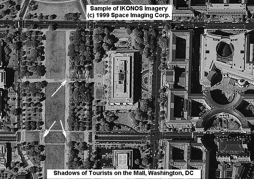
Shadows of Tourists on the Mall

US Navy Vessels Docked in San Fransisco
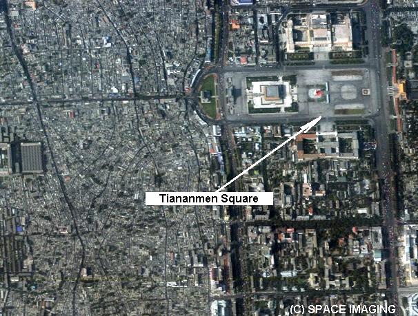
Beijing, China 4-Meter Multispectral
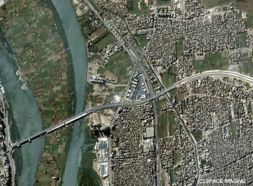
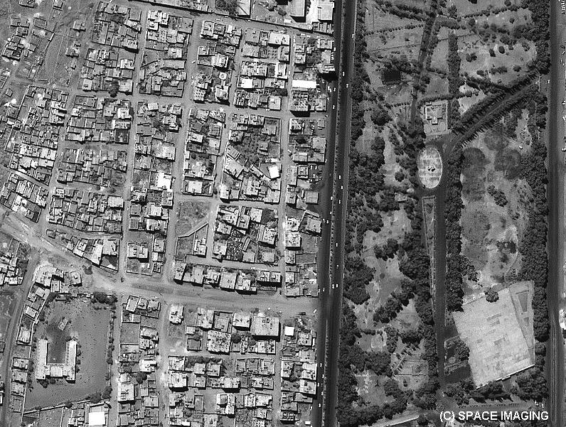
Cairo, Egypt 4-Meter Multispectral

Manhattan, New York, 1-Meter Pan

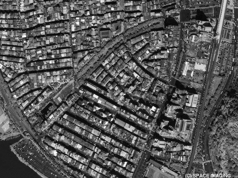
Sapporo, Japan 4-Meter Multispectral
Ground resolution
of each band: 4-meter multispectral
The ground processing
software has the capability to rapidly process and mosaic imagery
so as to create seamless image products with a consistent pixel
ground sample distance (GSD) Panchromatic: Multispectral: Nominal swath width: 12-meter horizontal and
10-meter vertical accuracy with no ground control 2-meter horizontal and
3-meter vertical accuracy with ground control These are specified
as 90% CE (circular error) for the horizontal and 90% LE (linear
error) for the vertical Altitude Inclination Speed Descending nodal
crossing time Revisit frequency Orbit time Orbit type Viewing angle
IKONOS

September
24, 1999 (11:21:08 am PDT)
Launch
Vehicle
Athena
II
Launch
Vehicle Manufacturer
Lockheed
Martin
Launch
Location
Vandenberg
Air Force Base, California
Resolution
1-meter panchromatic
(nominal at <26deg off nadir)
(nominal at <26deg off nadir)
Imagery
Spectral Response
0.45 - 0.90 microns
#1: Blue 0.45 - 0.52
#2: Green 0.52 – 0.60
#3: Red 0.63 - 0.69
#4: Near IR 0.76 - 0.90 (same as Landsat 4&5 TM Bands #1-4)
Spectral
Bands
Swath
Widths
& Scene Sizes
13 km at nadir
Areas of interest:
a nominal single image at 13 km x 13 km
Metric
Accuracy
Orbital
Information
423
miles / 681 kilometers
98.1
degrees
4
miles per second / 7 kilometers per second
10:30
a.m.
2.9
days at 1-meter resolution;
1.5 days at 1.5-meter resolution
These values are for targets at 40 degrees latitude.
The revisit times will be more frequent for higher latitudes and less
frequent for latitudes closer to the equator.
98
minutes
sun-synchronous
Agile
spacecraft - in-track and cross-track pointing
Weight
1600
pounds
Space Imaging released the world’s first high-resolution commercial satellite image of the Earth. The one-meter resolution black-and-white image of Washington, D.C., collected by Space Imaging’s IKONOS satellite, has unprecedented clarity and detail for commercial space imagery. The image showcases part of the Mall area in the heart of Washington D.C., and is downloadable from the Space Imaging Web site.
The IKONOS satellite orbits the Earth in a sun-synchronous orbit - meaning it simply follows the sun as it travels around the globe - and its Eastman Kodak-built camera is an optical imaging device. The near-perfect optical sharpness of Kodak’s telescope has never been achieved in any commercial space camera. The satellite circles the globe 14 times per day, or once every 98 minutes. The imagery is stored in Space Imaging’s digital CARTERRA™ archive and can be made available to customers very quickly - in as little as a few hours or days.
September 29, 1999 Since the successful launch of IKONOS Friday, September 24, 1999, the launch team has been making good progress on the checkout plan. The satellite is performing as expected and the ground systems are functioning well. Although we have a long way to go, we are encouraged by the progress we are making and should be able to meet our 90-day check out and acceptance plan.